
TravelCoda · Trip report · Kinnaur, Himachal Pradesh
Yulla Kanda Trek Guide: Route, Cost & What It's Really Like to Go Independently
It was pitch dark, we had no network, and the trail back to Yulla Khas had disappeared under water.
We'd left the temple hours earlier, feeling good about ourselves. Then my brother started struggling with the altitude, the mud turned the descent into a slip-and-fall obstacle course, and somewhere near the gate we simply lost the path. There was water everywhere, no signal to call anyone, and nothing to do but shine a torch into the dark and shout in case someone shouted back. Nobody did. Eventually we noticed a few cows standing in the flooded stretch ahead and figured — correctly, it turned out — that if the water wasn't too deep for them, it probably wasn't too deep for us either. We waded through. We found the gate. We were relieved in a way that's hard to explain unless you've been properly, unglamorously lost on a mountain.
That night we found out we weren't even the last ones down. Another couple had gotten lost too, and turned up at the same camp not long after us.
If you search for the Yulla Kanda trek right now, you'll mostly find trekking-company pages: fixed departure dates, tents, a trek leader, meals included, everything decided for you. Ours wasn't that trip. We booked our own buses, stayed in a homestay instead of a tent, had no trek leader, and figured things out — sometimes well, sometimes not — as we went. This is what that actually looked like, plus the practical details you need if you're considering doing it the same way.
The timeline
Yulla Kanda trek, day by day
Everything above laid out by section — here's the same trip in the order it actually happened, start to finish.
-
Day 1
Delhi → Shimla
Overnight bus booked through a tour company, departing Delhi around 11pm and reaching Shimla by roughly 8am the next morning.
₹1,100 / person -
Day 2
Shimla → Tapri → Yulla Khas
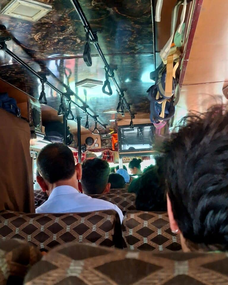
Boarded a private Shimla–Reckong Peo bus by about 8:30am, reaching near Tapri by roughly 5:15pm. The onward bus to Yulla Khas was too crowded, so we hired a cab instead. From the drop-off, it was a 0.8 km climb — almost entirely stairs — up to Bayul Homestay, made harder by rain and a wheeled suitcase that had no business on that staircase. The homestay owner and a labourer came down partway to help with the bags.
Bus ₹520/person · Cab ₹267/person · Homestay ₹1,100/person -
Day 3 · Morning
The climb to the temple
Up at 5am, breakfast at 6:30am, trekking by 8am — already a later start than planned. Reached "the gate" and were told the temple was still about 3 km off. That's where one of us turned back while the other pushed on solo, joining a separate group on the trail (including Abhishek) and, in the rush, leaving a trekking bag — with the raincoat inside — behind. Reached the temple cold, misty, and without rain gear until Abhishek lent his own.
-
Day 3 · Evening
Lost on the descent
Heading down, altitude symptoms and muddy falls slowed the pace. Near the gate, the trail disappeared under standing water in the dark — no phone signal, no response to calls for help. Waded through the flooded stretch using a few cows as a rough depth guide, found the gate, and booked into the nearest camp for the night rather than push on blind.
Emergency camp ₹1,000 / person -
Day 4
Back to Yulla Khas, and onward
Descended from the camp back to the homestay, then hitchhiked a lift toward Tapri and caught the bus on to Reckong Peo — the start of the next leg of the trip.
Hitchhike ₹500 · Bus ₹80
Yulla Kanda trek at a glance
- Location
- Rora Valley, Kinnaur district, Himachal Pradesh
- Base village
- Yulla Khas (Nichar Tehsil), roughly 2,985m
- Altitude at temple / lake
- ~3,895m (12,778 ft), per multiple cross-checked trekking guides
- Destination
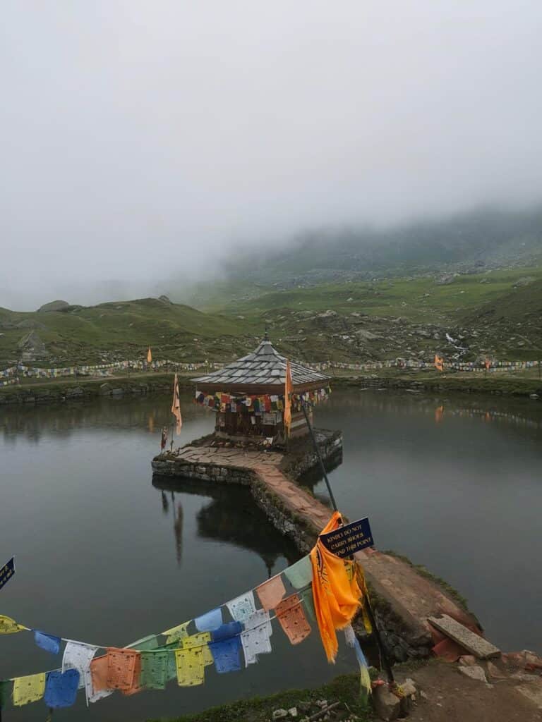
- Krishna Temple, on the edge of Yulla Kanda Lake — widely (but not independently verifiably) described as the highest Krishna temple in the world
- Trek format
- Can be done independently (no fixed trek leader required) or as a guided package
- Accommodation
- Homestay in Yulla Khas before/after the trek, or an emergency camp stay if things go sideways like they did for us
- Distance
- Most sources cite ~11–12 km one way / ~22–24 km round trip — see the route section for caveats
- Cost (independent, our trip)
- Roughly ₹3,000+ per person for the transport-and-stay portion — doesn't include food, the ₹500 hitchhike lift, or the flat Delhi–Shimla group fare
- Best time
- Roughly mid-May to mid-October, consistent across published trekking guides
The place
Where is Yulla Kanda?
Yulla Kanda sits in the Rora Valley in Kinnaur district, Himachal Pradesh, reached via the base village of Yulla Khas (itself at roughly 2,985m) in Nichar Tehsil. Published trekking guides consistently put the temple and lake at 3,895 metres (12,778 ft), and the temple — sitting beside a small alpine lake — is widely described online as the highest Krishna temple in the world. That specific "highest" claim shows up repeatedly across trekking sites, but it isn't something we can independently verify or vouch for, so treat it as a commonly repeated claim rather than a confirmed record.
The altitude, location and season figures above come from cross-checking multiple independent trekking guides, so we're reasonably confident in them. What we can talk about first-hand is what it's like to actually get there and back on your own.
Getting there
How to reach Yulla Khas without booking a package
We started in Delhi. A tour company had a Delhi–Shimla overnight bus for ₹1,100 per person, departing around 11pm, and we reached Shimla by roughly 8am.
From Shimla, instead of the HRTC (state transport) bus, we found a private bus toward Reckong Peo for ₹520 per person and managed to board it by about 8:30am. This is the main NH-5 corridor — the Hindustan-Tibet Highway — running through Narkanda and Rampur toward Kinnaur.
We got off near Tapri in the late afternoon. The bus onward to Yulla Khas was too crowded to deal with, so we hired a cab instead for ₹800 total, split three ways — about ₹267 per person.
This is the short version. A full breakdown of bus timings, HRTC vs. private options, and what to do if you miss a connection deserves its own space.
How to Reach Yulla Khas From Shimla and Tapri
Before the trek
Where to stay before the trek
We stayed at Bayul Homestay in Yulla Khas — ₹1,100 per person, including breakfast and dinner.
The homestay itself is about 0.8 km uphill from where the cab drops you, and it genuinely feels like more than that, because the entire stretch is stairs. We were carrying trekking bags, except one of us had brought a wheeled suitcase, which is about as bad an idea as it sounds on a staircase like this. It started raining halfway up. Eventually the homestay owner came down with a labourer to help carry the luggage the rest of the way, which we were very grateful for.
If you're going independently, budget extra time — and ideally pack light enough that you're not relying on someone else to bail you out on the stairs.
The route
Yulla Kanda trek route
Here's where we need to be upfront about something: total trek distance isn't fully settled even across published sources. Cross-checking several independent trekking guides, the most consistently repeated figure is roughly 11–12 km one way from Yulla Khas (around 22–24 km round trip), though a few sources give lower or higher totals depending on where exactly they start and stop measuring, and whether they're counting a base-camp version versus a return all the way to the village in one push. We're not picking one number and presenting it as gospel, because we didn't measure the trail ourselves.
What we can tell you is what we personally experienced:
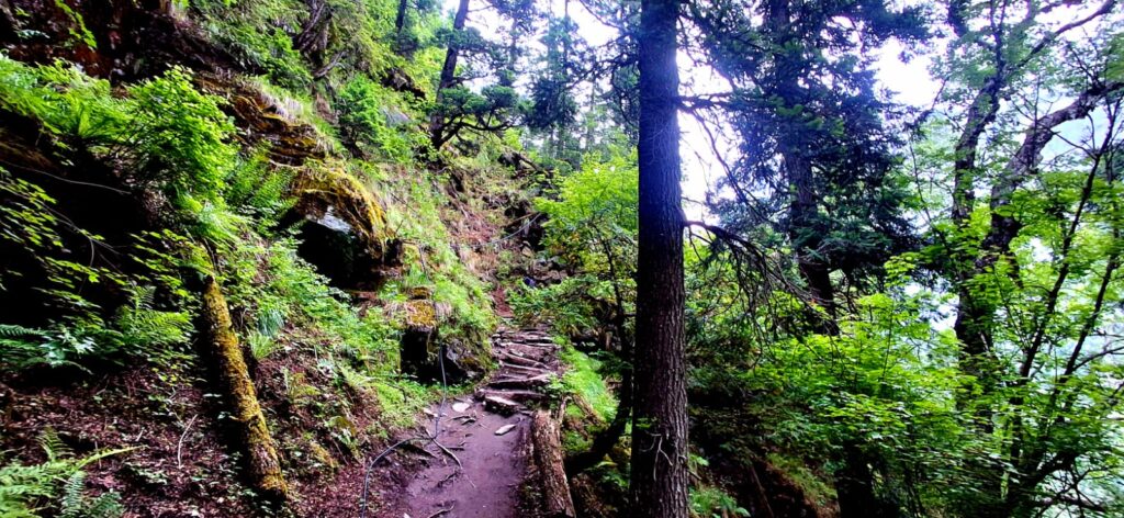
- The trail out of Yulla Khas is mostly stairs and a steady, sustained climb.
- We started early and reached a point locals call "the gate," after which the trail steepens noticeably.
- From the gate, we were told the temple was still about 3 km away.
- Later in that final stretch, someone else on the trail told us it was roughly 2 km more from where we were.
That's the honest picture: the last section felt long, kept getting subdivided by different people's estimates, and doesn't match a single tidy number. If you're planning your own attempt, treat any "X km" figure you read — including ours — as an approximation, not a promise.
The difficulty
How difficult is the Yulla Kanda trek?
Most package pages describe this trek with the usual "easy to moderate" label. Based on what we went through, that undersells it — or at least, it doesn't tell you what actually makes it hard.
We started later than planned because we wanted breakfast first, which pushed the whole day back. The trail alternates between long stretches of walking and standing around waiting for each other to catch up, and it rained on and off through the day, which made the stone stairs and mud sections more work than dry conditions would have been. The final 2–3 km past the gate is noticeably steeper than everything before it, and this is where fatigue really shows — I was dealing with health issues that day, which made the pace much harder to sustain, though I'm not going to speculate on exactly what caused that.
The difficulty isn't really about elevation gain on paper. It's about how conditions on the day — rain, mud, a late start, how your body happens to be doing — can turn a "moderate" trek into something that genuinely tests you. That was true for us on the way up, and even more true on the way down.
The climb
Our Yulla Kanda trek experience
We got a later start than we should have, mostly because we didn't want to skip breakfast. In hindsight, that hour mattered.
The trail began climbing almost immediately, and it settled into a pattern: walk for a stretch, stop, walk again. It rained on and off. None of it felt dramatic in the moment — it was just steady, unglamorous effort, made slower by the wet stone.
We reached the gate and were told the temple was still about 3 km off. That's where things got complicated for us personally. One of us was struggling and decided she couldn't continue. The plan, briefly, was for both of us to turn back together. We got about half a kilometre back down before I decided that didn't sit right — I turned around to continue the summit push alone, while she carried on down at her own pace.
That's a call worth being honest about: heading back up solo, with a friend continuing down alone, isn't something we'd casually recommend to anyone reading this. It worked out. It could easily not have.
Heading back up alone, I joined a separate group of guys making the same trek, including someone named Abhishek — and at one point I left my trekking bag, with my jacket and raincoat packed inside it, behind on the trail to move faster. That's flagged here deliberately: it was a bad decision. It meant reaching the temple with no rain protection of my own.
The temple itself came into view between the clouds — cold, misty, genuinely striking. Abhishek lent me his raincoat there, which made a real difference given the conditions. My brother, who'd gone ahead solo earlier in the day, turned up at the temple too, and there was time for photos together before the weather made it clear it was time to start heading down.
The descent
What went wrong on the descent
The descent is where the trip stopped being merely tiring and became genuinely difficult.
Early on, the brother began showing signs consistent with altitude — we're not going to attach a medical label to it, just describe what was visible: he was struggling more than the descent itself should have caused. The path down had turned slick with mud, and without proper trekking shoes, he fell several times — not from any misstep on his part, just the ground itself giving way underfoot.
By this point it was just the two of us — the two siblings who'd made this trek together, with the friend already back at the homestay and the group from earlier gone their own way. By the time we should have been nearing the gate again, the trail had become unrecognisable. Water had spread across the path in the dark, visibility was poor, and there was no phone signal at all. We called out for help and got no answer. We used a torch to signal in case anyone nearby could see it. Eventually, rather than wait indefinitely, we decided to wade through the standing water — a few cows visible further along the flooded stretch became an unlikely but useful signal that the water wasn't too deep to cross safely.
The gate reappeared, and with it, real relief. Rather than push further in the dark, we booked the nearest camp for the night — ₹1,000 per person, including dinner and breakfast. It was only afterward, from other people at the camp, that we learned another pair of trekkers had also lost the trail that night and eventually made it down safely too.
There's more to this story than fits here — the full account of that night, including how contact was eventually made with family back home with no signal on hand, deserves its own space.
The Night We Got Lost Coming Down From Yulla
The packing list
What to carry for Yulla Kanda if you're going independently
We didn't camp on this trek, so this isn't a camping-gear list — it's what actually mattered to us as a day-hike-plus-homestay setup, based on what helped and what we wished we'd had.
- Proper trekking shoes. The difference between having them and not having them was the difference between a hard descent and a genuinely dangerous one — the muddy, slippery sections punished anyone without solid grip.
- Rain protection you keep on you, not in your bag. Leaving a raincoat packed away at a point along the trail meant reaching the temple with no protection of our own. Don't repeat that mistake — keep it accessible, not buried.
- A warm layer. It's genuinely cold at the temple, especially with cloud cover and rain moving in.
- A torch or headlamp. This wasn't a nice-to-have — it's what we used to try to signal for help when we lost the trail after dark.
- A charged phone and power bank. Network isn't guaranteed everywhere on this route — we had Airtel and it worked reasonably well through most of the trek, with only a few patches where it dropped out entirely, including, unfortunately, right around where we lost the trail on the descent. Carry it anyway, both for the stretches where it does work and for photos and navigation apps that function offline.
- Basic emergency essentials. First-aid basics, some way to purify or carry extra water, and food that doesn't depend on stopping anywhere.
None of this is exotic gear. It's mostly things we either had and were glad of, or didn't have and felt the absence of directly.
The cost
Yulla Kanda trek cost — what we actually spent
These are only the figures we can actually confirm from our own trip. Where something is genuinely unclear — like whether a fare was per person or total — we're saying so rather than guessing.
| Item | Cost |
|---|---|
| Delhi → Shimla overnight bus | ₹1,100 (tour company, flat) |
| Shimla → Reckong Peo route bus (private, non-HRTC) | ₹520 / person |
| Tapri → Yulla Khas cab (₹800 total ÷ 3) | ₹267 / person |
| Bayul Homestay, Yulla Khas (incl. breakfast & dinner) | ₹1,100 / person |
| Emergency camp near the gate (incl. dinner & breakfast) | ₹1,000 / person |
| Hitchhiked lift, Yulla Khas toward Tapri | ₹500 |
| Tapri → Reckong Peo bus | ₹80 (likely per person) |
We can't reconstruct a single reliable grand total from our notes — some fares weren't recorded clearly enough to add up with confidence, and we're not going to fill that gap with a guess. If you're budgeting, treat the table above as your baseline and pad it for food, any local transport we didn't itemise, and a buffer for the kind of unplanned costs — like an emergency camp stay — that independent travel occasionally throws at you.
If you're comparing this against a fixed-departure trekking package instead, be aware that those prices are set by tour operators, typically bundle transport, tents, meals and a trek leader into one figure, and aren't something we can verify or vouch for ourselves — they're a different product from what we did.
The verdict
Is Yulla Kanda worth it?
Yes — with real caveats, not the generic kind.
The temple appearing between the clouds after a long, wet climb is a moment that's stayed with us. So is how remote it can feel once you're past the gate — network coverage was actually decent for most of the route (we had Airtel, and it held up well), but it dropped out completely in a few patches, and it was exactly one of those patches where we lost the trail in the dark. That combination — mostly-fine coverage that fails you at the one moment you need it — is part of what makes the remoteness real, and part of what made that night genuinely risky.
Going independently meant no trek leader making the calls, no one automatically checking headcounts on the way down, and no fallback plan when the trail disappeared underwater in the dark. We got through it. We also got lucky in some fairly specific ways — a stranger who happened to lend a raincoat, cows that happened to be standing in exactly the right spot, a camp with space for us near the gate.
If you're reasonably fit, comfortable making decisions under pressure, and okay with the idea that you might end up handling a genuine problem with no outside help, doing this independently is a real option — and a much cheaper, more personal one than a package trip. If the idea of losing the trail after dark with no signal sounds like more risk than you want to take on, a guided departure with a trek leader is a legitimate and sensible choice instead. There's no need to feel like independent is the "real" way to do it — it's just the way we did it, for better and worse.
The questions
Yulla Kanda trek FAQs
Via Shimla and the NH-5/Hindustan-Tibet Highway toward Kinnaur, getting off near Tapri and continuing to the base village of Yulla Khas, from where the trek begins. We travelled this route by a mix of overnight bus, a private Shimla–Reckong Peo bus, and a local cab for the last stretch — see the transport section above for our actual fares and timings.
We did — no trek leader, no fixed group, just our own planning. It's possible, but it comes with real risk, particularly on the descent, where we lost the trail after dark with no phone signal. If you're not confident navigating and problem-solving without support, a guided trek is a reasonable alternative. On permits: most published guides we checked say no formal permit is required for the trek itself, though this is worth confirming locally before you go, since we found at least one source claiming otherwise that we couldn't corroborate against anything else.
Harder than a simple "easy/moderate" label suggests, at least in the conditions we had. Expect a genuine, sustained climb, a noticeably steeper final stretch, and difficulty that can spike sharply if it rains or if the trail is muddy on the way down.
For our transport-and-stay leg specifically (Shimla onward), we spent roughly ₹3,000+ per person, not counting food, the flat Delhi–Shimla fare, or the ₹500 hitchhike lift (unclear if that was per person or total). Full breakdown above — we're not presenting this as a complete trip total, since parts of our own spending weren't clearly itemised enough to add up with full confidence.
Published trekking guides most consistently cite roughly 11–12 km one way from Yulla Khas (around 22–24 km round trip), though figures vary a bit depending on where a source starts and stops measuring. We can only confirm what we were told on the trail ourselves: roughly 3 km from "the gate," with a later estimate of about 2 km more in the final stretch.
We stayed at Bayul Homestay in Yulla Khas, about 0.8 km (mostly stairs) above where transport drops you. More detail in our accommodation guide.
Solid trekking shoes, rain protection you can access quickly, a warm layer, a torch or headlamp, and a charged phone with a power bank — full reasoning above, based on what actually helped or hurt us.
Mid-May to mid-October, consistently across multiple published trekking guides. We visited in this window ourselves, though we can't speak to conditions outside it since we haven't done the trek at other times of year.